Training on Emergency Response Mapping by Utilizing OSM
21 Jan 2020 03:24 WIB

Foto : Training on Emergency Response Mapping by Utilizing OSM ()
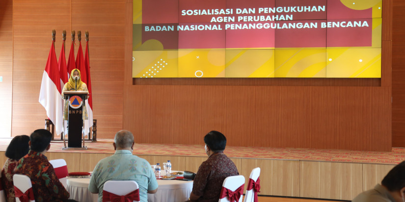
JAKARTA – Emergency Operation Center (Pusdalops) BNPB conducted a training on emergency response mapping using Open Street Map (OSM) at Graha BNPB, East Jakarta on Sunday (20/1).
The training was attended by 18 participants from EOC and presented a speaker from Humanitarian Open Street Map Team or HOT.
Director of EOC BNPB Bambang Surya Putra said that the training’s objective to enhance capacity, knowledge and skill among the EOC members by utilizing OSM during emergency.
An expectation of the training is that they are able to applicate immediately in processing spatial data during emergency.
Material of the training is an introduction of HOT export tools, YAML usage, Overpass Turbo, Open Aerial and Tasking Manager 3.
During a session on the HOT Export Tools, the participants obtained knowledge on how to download OSM data by utilizing Hot Export Tools, which is open source to be used for downloading the latest OSM data. It is also useful for user to download in certain area.
According to Fatisya Ilani Yusuf from HOT Indonesia, benefit of Hot Export Tools is able to provide format spatial data choices such as ESRI shapefilie (.shampefile), google KML (.KML), GeoPack dan MBTiles (.mbtiles). Besides, the user is able to customize an area and categorized data that will be downloaded by using Hot Export Tool.
The method for downloading data is very easy and there are no requirements except to only use an OpenStreetMap account and include data sources for credit licenses on the products made.
Then in the second material, the participants were given an introduction about the use of YAML (YAML Ain't Markup Language) on the Hot Export Tool by Sheila Amalia. YAML is a simple data structure that can be used in all programming languages. YMAL can be used to create data structures that are customized with OSM data (key and value) tags.
YAML, continued Sheila, in the Hot Export Tool is used to filter OSM data, based on the preserts used when entering OSM data.
The next speaker, Adityo Dwijonanto delivered material on how to get OSM data with Overpass Turbo, OpenAerialMap and Introduction to Tasking Manager v.3.
The interesting thing from OpenAerialMap, according to Adityo is how the results of aerial photographs conducted by the team in the field using drones, can later be uploaded in a link to be directly accessed in the form of services by everyone. Adityo further suggested that the aerial photographic data is stored in a google drive first, to anticipate when the internet network is not good and the data is safe.
For the introduction of Tasking Manager V.3. Adityo explained the advantages in terms of views that are different from previous versions. In this version the user can see the dashboard, determine the size of the taxi and can be adjusted according to our request.
In term of validation, the old version, it will take one by one, while the latest version V.3, it can validate directly after being customized. However requirement the user should have row project manager and only project manager who is able to validate it.
"Another advantage, from this version 3, there is a validation status and progress and the number of contributors can be seen, this makes it easy for us to report to the leadership," Adityo Dwijonanto said. (Ws)
Agus Wibowo
Head of Data, Information and Disaster Comm Center BNPB
Admin


